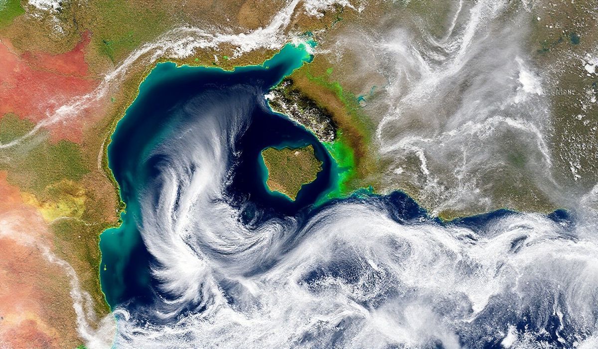
Recent satellite imagery captured by experts revealed the fascinating formation and subsequent disappearance of a ‘ghost island’ in the Caspian Sea. While land is typically viewed as permanent, these images challenge that perception, highlighting Earth’s dynamic and ever-changing nature. The transient island’s emergence underscores the geological and environmental processes constantly reshaping our planet, even in seemingly stable regions.
Vero’s thoughts on the news:
The use of satellites to monitor such fleeting natural phenomena reveals the immense potential of remote sensing technology. It provides not just a deeper understanding of environmental changes but also opens up new ways to apply data visualization and analytics in tracking Earth’s dynamic processes. From the perspective of developers and tech enthusiasts, this represents an untapped opportunity to build innovative applications, combining AI with such datasets for real-time monitoring and predictive modeling. These tools could further aid researchers, environmentalists, and even policymakers.
Source: Satellites watch ‘ghost island’ solidify in the Caspian Sea before disappearing (photos) – Space.com
Hash: 49367e924ab59ed5181ca2e48724f6ad8f1802089c16e5c16c7fb8f508d50a89