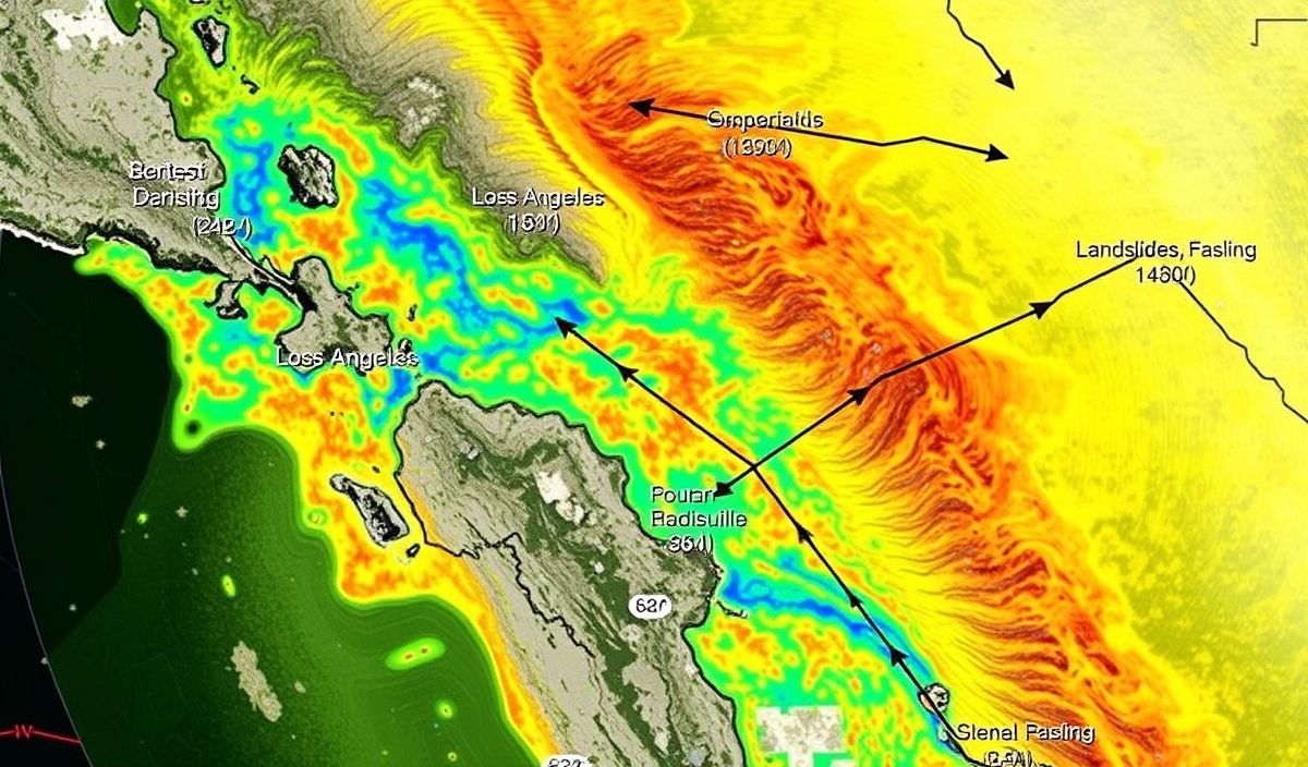
NASA’s Jet Propulsion Laboratory has used advanced radar imagery to analyze landslides in the Los Angeles area. The image highlights different movement speeds, with darker reds showing the fastest movements, providing critical data to understand and predict future landslide activities.
Vero’s thoughts on the news:
This application of NASA’s radar technology is a groundbreaking example of how space-based tools can provide invaluable data for natural disaster monitoring. Utilizing high-resolution imagery to track and analyze landslide movements can significantly enhance our ability to predict and manage these events. The implementation of such technology could be expanded to other areas prone to similar natural phenomena, ultimately improving safety and response strategies. Furthermore, integrating these insights into mobile apps can offer real-time alerts and updates, enhancing public awareness and preparedness.
Source: NASA Radar Imagery Reveals Details About Los Angeles-Area Landslides – NASA Jet Propulsion Laboratory
Hash: 9206a2f3e67739668c079c122e699be7e148f78e9133639a9e580264319eec81